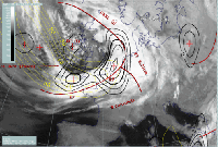
CineSat Benefit for the User
With CineSat you will . . .

- Increase airspace safety by detecting hazardous weather events
- Spot weather trends at a glance
- Save your time for higher level weather analysis tasks
- Offer a better real-time weather information service
- Save airline's money by better airspace utilization
- Save human life by early disaster warning
CineSat increases the quality of operational weather forecasts

In practice, the routine forecaster has to provide within a minute's time an ad hoc assessment of the weather development for different geographical areas, often in response to a customer's telephone inquiry.
Having operational nowcast products available that immediately convey the relevant information without further preparation, reduces the workload, response time, and subjectivity.
CineSat saves the forecaster´s time for a higher level assessment of the weather situation.
Detect hazardous developments well in advance

Most hazardous weather events have a short life cycle of only a few hours, and, therefore, often do not correctly appear in the conventional, medium-range numerical weather prediction models. Since especially these weather events are extremely critical in many fields - e.g. for air traffic - an accurate short range weather forecast is vitally important.
CineSat´s image change detection tool separates cloud movement from cloud development. This makes it possible to automatically derive indicators for cloud development which focuses the forecasters attention to changing cloud systems.
All cloud configurations that are not explicable by simple movement of previously known systems can be automatically identified as new developments - and classified either as decaying or developing systems.
CineSat brings more safety to aviation

Safety is a crucial factor in aviation. Conventional numerical model forecasts are based on measurements that are at least some hours old, and thus, do not always reflect the actual situation. This is an important risk factor for critical decisions.
CineSat uses the most recent and exhaustive measurements available - the weather satellite images. No passenger and no airline would understand that these data are principally available, but not fully exploited for their safety.
Especially in those meteorological areas where highly precise short term forecast is demanded, CineSat proofs to offer the kind of value adding you would not want to miss again as soon as you´ve tried it once.
CineSat analyses and predicts cloud and thunderstorm movement
CineSat measures the movement of clouds from a series of satellite images and computes a short range forecast for the next few hours. It predicts and plots satellite images 3 hours ahead. Additionally, CineSat can move phenomena that have been detected, e.g. from observations or by the weather radar, along their expected path for the next few hours.
With CineSat you'll spot trends at a glance.
Thus saving your time for higher level analysis tasks.
Based on a better pre-processing and an initial computer diagnosis, you win time for a more detailed assessment of the expected future situation. Now you can use all your creativity for your main and very demanding task - a best possible forecast.
CineSat provides you with real-time weather forecasts
Short range weather forecasts must be based on the latest data and must be available almost immediately.
CineSat includes an advanced image motion module that identifies cloud movement and cloud changes 20 times faster than standard image processing techniques. This makes it possible to produce the nowcast products on today´s standard desktop computers within a few minutes after image reception.
In typical configurations, CineSat …
- detects convective cloud cells
- computes cloud development maps
- predicts cloud movement 2-4 hours ahead
- draws predicted trajectories of approaching weather
- interpolates smooth animation movies
- predicts future satellite images
CineSat is at the leading edge of nowcasting and real-time image processing technology.
Spot trends at a glance
Looking at an animation loop over the most recent satellite images and extending this animation some hours into the future gives the forecaster an instant and intuitive understanding of the expected flow of clouds and air masses.
Additionally, you can instantly detect cloud systems which are likely to bring up new developments by means of CineSat´s cloud development maps.
CineSat complements conventional weather prediction techniques
CineSat is not intended as stand-alone forecasting system. It perfectly complements existing forecast data with highly actual and precise information derived from the most recent satellite image data.
CineSat´s forecast products turned out to be a valuable new source of real-time information even for the European region, where fine-mesh numerical weather prediction models and a dense network of synoptic measurement stations are available. Forecasts based on satellite imagery are vitally important in regions with only a few observation stations, e.g. over ocean areas.
Better use and verification of NWP models

Users report that they come to appreciate CineSat´s image based predictions as an assessment of a situation that is independent from numerical weather prediction models.
Knowing where a NWP model does not exactly match a situation, its parameters can nevertheless often being used by taking into account their observed geographical displacement.
CineSat - A verified technology
CineSat methods and results have been validated in long-term studies and in continuous and successful operational use by the European Space Operations Centre, the Austrian Central Institute for Meteorology, and the German Weather Service.
Air Traffic Control authorities as well are very satisfied and convinced by the high-quality forecast results of CineSat.


